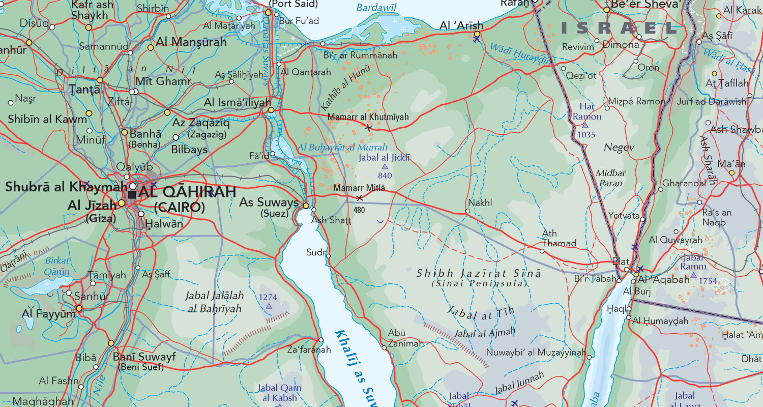
World Panorama WGS84
World map data – Raster – Platte Care Projection
Technical Detail
The Data
Collins Bartholomew World Panorama WGS84 is a global digital map in raster format, consistent in scale, content and specification across the whole world.
Based on a Plate Carrée map projection, the world has been divided into 48 tiles (8×6) with each tile covering 45 degrees longitude and 30 degrees latitude. The tiles are designed to butt at the edge with no overlap.
The map was created directly from Collins Bartholomew’s World Explorer Premium vector data which is continuously maintained and released quarterly.
Boundaries are shown according to Collins Bartholomew’s geopolitical policy which aims to describe an accurate, neutral position appropriate to the data scale. Where there are areas of dispute, these are highlighted using textual descriptions on the map, e.g. “Administered by India, claimed by Pakistan”. First order internal administrative boundaries are included for all countries where appropriate although only the larger countries have their divisions named.
This product is used in a variety of applications and institutes such as academic research, creation of maps for television broadcast, defence and strategic planning, the production of customised printed and web-based mapping.
World Panorama is best viewed at a map scale of approximately 1:2,500,000.
Data Format
World Panorama is supplied in TIFF format with associated georeferencing files such as .AUX.XML, .TFW, or .TAB. The TIFF images can also be used as stand-alone GeoTIFFs since the coordinate system and extent information is embedded in the header.
The images are available as 8 bit, 256 colour colour-indexed TIFFs at 300dpi resolution by default. If you require higher quality files then please contact us using the details below.
All the images were generated entirely by digital methods with no optical scanning involved. The colours should be pure and consistent throughout the complete set of images.
Geographic Coverage
World Panorama covers the entire globe: 90N to -90S in latitude and 180W to 180E in longitude.
Coordinate Information
WGS 1984 datum (WKID: 4326) shown in Plate Carrée projection
Product Update Cycles
World Panorama is updated annually, released in June.
Quality Standards
Collins Bartholomew takes the greatest of care in assuring the high quality of our data. The data is constantly being updated and revised, with an average of 40,000 name edits each year.
All our database updates are thoroughly researched by our highly dedicated in-house team of professional cartographers and information researchers.
We also use external experts, specialist organisations, official organisations, agencies, government departments and business offices to assist in the information gathering process.
Policy changes (e.g. international boundary changes, new country depiction, name changes) are informed by external experts. For advice on name forms we look to the PCGN (the UK government’s Permanent Committee on Geographic Names for British Official Use) and BGN (US Board on Geographic Names) plus of course local/country specific information. From this we would make our decision on the ‘de facto’ stance and apply geographical expertise to work out the details.
Licensing
World Panorama is available as a standalone dataset that you can download and store locally, or it can be accessed via one of our secure web services. Whichever you choose, our licence fees are based on the number of concurrent users with fees staring from £1,095 per annum.